Vive la FIL Quito en Buscalibre con hasta 60% DTO  Ver más

Enviar a
Quito, Pichincha
0
  • argentina
  • chile
  • colombia
  • españa
  • méxico
  • perú
  • estados unidos
  • internacional

Selecciona tu país

América

Europa

Resto del mundo

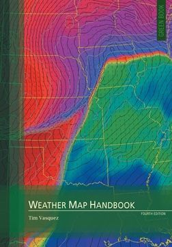
portada Weather Map Handbook, 4th ed. (en Inglés)
Formato
Libro Físico
Idioma
Inglés
N° páginas
196
Encuadernación
Tapa Blanda
Dimensiones
25.4x17.8x1.3 cm
Peso
0.47 kg.
ISBN13
9780996942355

Weather Map Handbook, 4th ed. (en Inglés)

Timothy Vasquez (Autor) · Weather Graphics Technologies · Tapa Blanda

Weather Map Handbook, 4th ed. (en Inglés) - Vasquez, Timothy

Libro Nuevo Importado
Envío: 21 a 28 días háb.
$ 158.55$ 87.20
-45%
Costos de importación incluídos en el precio ✅
Libro Nuevo

Quedan 100 unidades

$ 87.20
Llega entre el 29 Oct y el 13 Nov a Quito, Pichincha. Seleccionar ubicación

Reseña del libro "Weather Map Handbook, 4th ed. (en Inglés)"

Weather Map Handbook is a guidebook and encyclopedia of the most common weather forecasting charts used in operational forecasting in the 2020s. It's written by a veteran forecaster for other forecasters. All of the products are available on centralized systems like AWIPS and on the Internet on servers run by central weather agencies.Using a double-page format, the Weather Map Handbook demonstrates nearly every type of weather map, image, and product in common use. An overview of each item's origin, purpose, shortfalls, and tips are outlined. Standards for analysis symbology and chart markings are summarized. The surface, 925 mb, 850 mb, 700 mb, 500 mb, and 300-200 mb charts get two pages each, complete with philosophy, objectives, and techniques for each chart. Thickness, isentropic, and Q vector products get their own sections.The WSR-88D doppler radar, in use by the United States weather services, has played a vast part in the weather information revolution. In the Weather Map Handbook, it gets an entire chapter that covers reflectivity, velocity, spectrum width, and dual-polarization products. Some details provided in this book are drawn from obscure references and are now nearly impossible to find.From the NAM to the HRRR, from the GFS to the ECMWF, forecasters become grounded in the history and configuration of numerical forecast models. Ensemble forecasts are highlighted. The satellite chapter explains visible, infrared, and water vapor imagery, how it's created, and how to interpret it. Even the METAR, TAF, SYNOP, and radiosonde formats get their own sections, complete with decoding instructions. Whether you're a hobbyist, private forecaster, a professional, or a student, the Weather Map Handbook is the essential reference book.

Opiniones del libro

Preguntas frecuentes sobre el libro

Todos los libros de nuestro catálogo son Originales.
El libro está escrito en Inglés.
La encuadernación de esta edición es Tapa Blanda.

Preguntas y respuestas sobre el libro

¿Tienes una pregunta sobre el libro? Inicia sesión para poder agregar tu propia pregunta.

Opiniones sobre Buscalibre

Ver más opiniones de clientes