Compartir
Low-Cost Space-Borne Data for Inundation Modelling: Topography, Flood Extent and Water Level: Unesco-Ihe PhD Thesis (en Inglés)
Kun Yan
(Autor)
·
CRC Press
· Tapa Dura
Low-Cost Space-Borne Data for Inundation Modelling: Topography, Flood Extent and Water Level: Unesco-Ihe PhD Thesis (en Inglés) - Yan, Kun
$ 97.11
$ 194.21
Ahorras: $ 97.11
Elige la lista en la que quieres agregar tu producto o crea una nueva lista
✓ Producto agregado correctamente a la lista de deseos.
Ir a Mis Listas
Origen: Estados Unidos
(Costos de importación incluídos en el precio)
Se enviará desde nuestra bodega entre el
Miércoles 03 de Julio y el
Viernes 19 de Julio.
Lo recibirás en cualquier lugar de Ecuador entre 1 y 3 días hábiles luego del envío.
Reseña del libro "Low-Cost Space-Borne Data for Inundation Modelling: Topography, Flood Extent and Water Level: Unesco-Ihe PhD Thesis (en Inglés)"
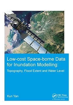
This thesis aims to explore the potential and limitations of low-cost, space-borne data in flood inundation modelling under unavoidable, intrinsic uncertainty. In particular, the potential in supporting hydraulic modelling of floods of: NASA's SRTM (Shuttle Radar Topographic Mission) topographic data, SAR (Synthetic Aperture Radar) satellite imagery of flood extents and radar altimetry of water levels are analyzed in view of inflow and parametric uncertainty.To this end, research work has been carried out by either following a model calibration-evaluation approach or by explicitly considering major sources of uncertainty within a Monte Carlo framework. To generalize our findings, three river reaches with various scales (from medium to large) and topographic characteristics (e.g. valley-filling, two-level embankments, large and flat floodplain) are used as test sites. Lastly, an application of SRTM-based flood modelling of a large river is conducted to highlight the challenges of predictions in ungauged basins.This research indicates the potential and limitations of low-cost, space-borne data in supporting flood inundation modelling under uncertainty, including findings related to the usefulness of these data according to modelling purpose (e.g. re-insurance, planning, design), characteristics of the river and considerations of uncertainty. The upcoming satellite missions, which could potentially impact the way we model flood inundation patters, are also discussed.

